Home · The Seine
Downstream
Seven bridges to know
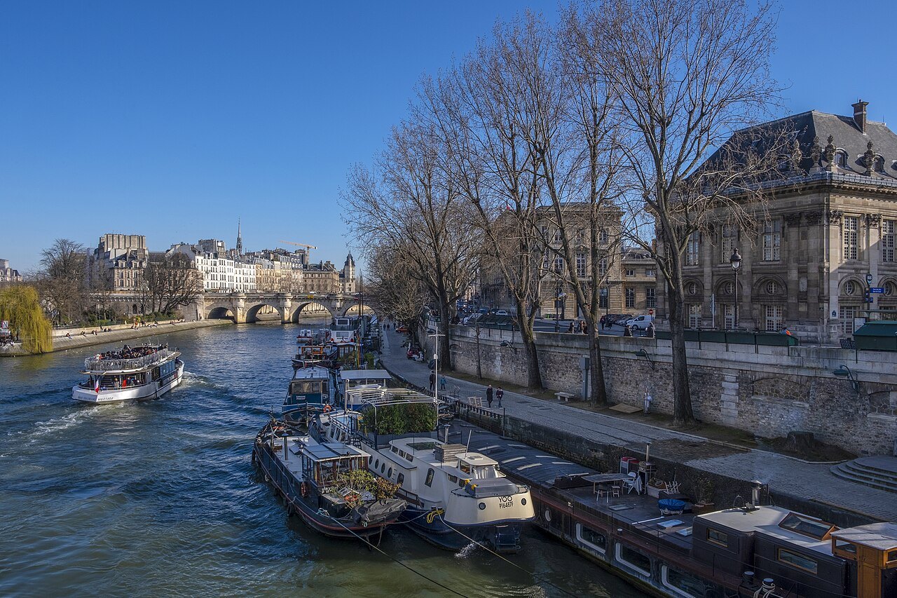
- 1578–1607Pont NeufThe new bridge is the oldest standing across the Seine in Paris, crossing both arms of the river at the tip of the Île de la Cité.
- 1614–1635Pont MarieStone arches to the Île Saint-Louis, named for the engineer Christophe Marie, who proposed it to develop the island.
- The islands' linkPont Saint-LouisThe only bridge between the two islands, for people on foot, behind the apse of Notre-Dame.
- 1802–1804Pont des ArtsThe first metal bridge in Paris, a footbridge between the Institut de France and the Louvre.
- 1896–1900Pont Alexandre IIIOne low steel arch and four gilded Fames, built for the exposition of 1900 on the axis of the Invalides.
- The ZouavePont de l'AlmaParisians judge a flood by the stone soldier on its pier: when the water reaches his thighs, boats can no longer use the river.
- 1903–1905Pont de Bir-HakeimTwo decks, cars below and Métro Line 6 above, crossing the Île aux Cygnes beside the Eiffel Tower.
In full
The Seine
The river that made the city
Paris began on the river. A Gallic people, the Parisii, settled here, and a trade route crossed the Seine on the Île de la Cité, the island that is still the city's heart. The Seine rises in Burgundy, northwest of Dijon, flows through Paris from east to west in a long curve, and reaches the English Channel at Le Havre. Inside the city it is spanned by thirty-seven bridges, and the city's two banks, the Right Bank to the north and the Left Bank to the south, are still the first way Parisians describe where anything is.
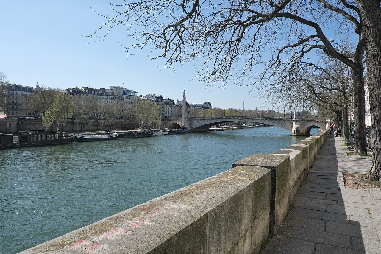
The banks of the Seine in the center, from the islands down to the Eiffel Tower and including the Louvre, have been a UNESCO World Heritage Site since 1991. Walking along them is the best introduction to Paris there is.
Over the centuries the river was walled in by stone quays, and the islands grew as sand built up against them: when the Pont Neuf was finished, it only grazed the downstream tip of the Île de la Cité, which now reaches well beyond it. Today the quays are the city's great promenade, with the monuments of five centuries lined up along them, and on a fine evening half of Paris seems to be sitting on the lower banks with their feet above the water.
The islands
The Île de la Cité is the older of the two islands and was the center of the medieval city, with the cathedral of Notre-Dame at its eastern end and the old royal palace, now the law courts, with the Sainte-Chapelle, in the middle. At its western tip, below the Pont Neuf, a small garden, the Square du Vert-Galant, is named after Henry IV, whose nickname was the Green Gallant; it is one of the best places in Paris to sit by the water.
Upstream, the Île Saint-Louis was used for grazing cattle, fishing and drying laundry, and was cut in two by a canal in 1360. From 1616 developers led by Christophe Marie filled the canal, laid out streets and built imposing town houses. It remains a quiet, residential island of narrow streets, reached by three bridges from the banks and one, the Pont Saint-Louis, from the Île de la Cité. Downstream, beside the Pont de Bir-Hakeim, the narrow artificial Île aux Cygnes carries a tree-lined walk and a quarter-scale replica of the Statue of Liberty.
The bridges
Of the thirty-seven bridges, five are for people on foot only and two carry railways. Eight link the Île de la Cité to the banks, three link the Île Saint-Louis, and one links the two islands to each other. The oldest is the Pont Neuf, the new bridge, begun in 1578 and finished under Henry IV in 1607; it was called new to distinguish it from the older bridges, which were lined with houses, and it has never carried any.
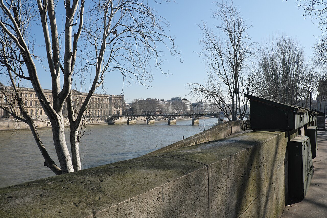
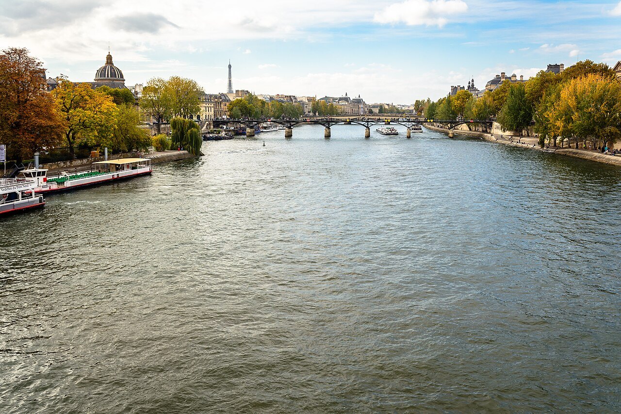
The Pont des Arts, between the Louvre and the Institut de France, was built as an iron footbridge between 1802 and 1804, the first metal bridge in Paris. From 2008, visitors took to attaching padlocks to its railings and throwing the keys into the river, until the weight of the locks threatened the bridge; in June 2015 the city began cutting them all away: more than a million locks, weighing about 45 tons. Please do not add locks to any bridge.
The most ornate is the Pont Alexandre III, of 1896 to 1900; the most photographed with the tower behind it is the Pont de Bir-Hakeim, whose upper deck carries Métro Line 6 across the river on a steel viaduct.
The quays and the bookstalls
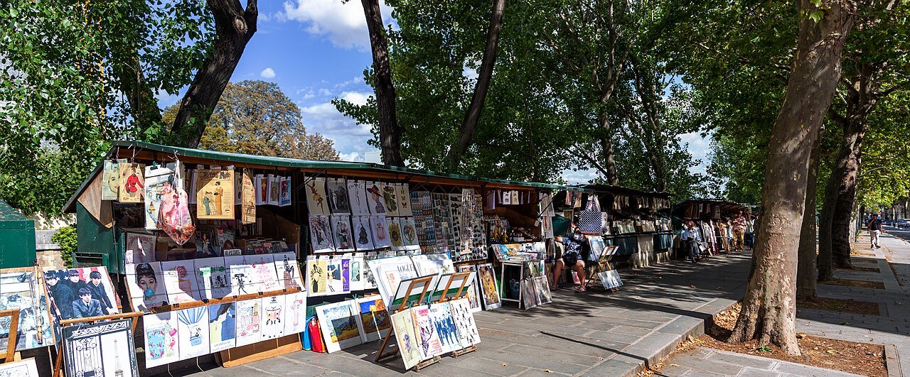
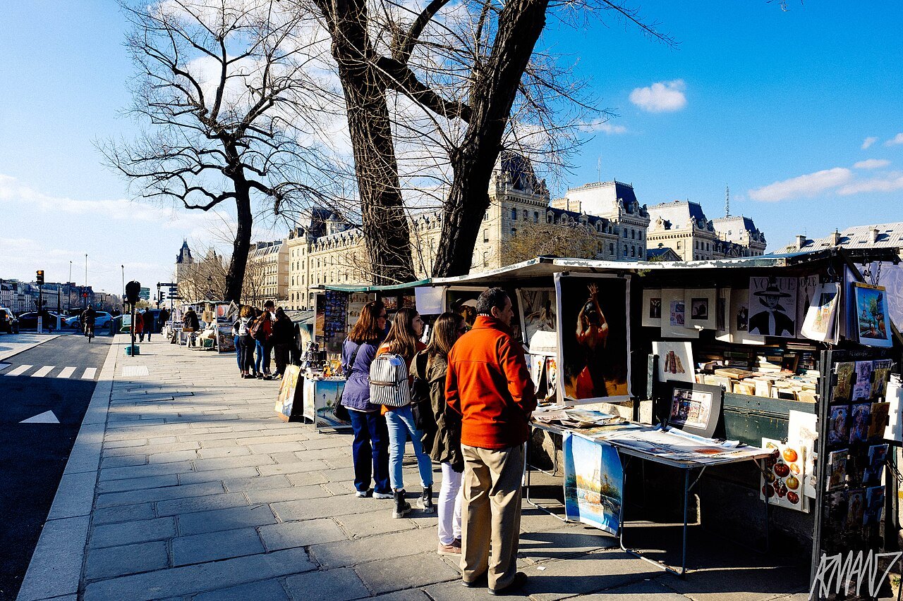
Along the stone quays of the center, the bouquinistes, sellers of old and secondhand books, prints and postcards, keep their dark green boxes on the parapets: on the Right Bank from the Pont Marie to the Quai du Louvre, and on the Left Bank from the Quai de la Tournelle to the Quai Voltaire. More than two hundred booksellers run some nine hundred boxes along about two miles of quays, and the Seine has been described as the only river in the world that runs between two bookshelves. The size of the boxes was fixed in 1930, and the booksellers' traditions have been listed as part of the country's intangible heritage since 2019.
Below the upper quays, the lower banks at the water's edge are for walking. In July and August the city turns stretches of the riverside roads into Paris-Plages, with sand, deck chairs and activities, and it has done the same beside the Bassin de la Villette since 2007.
On the water
The Seine is a working river as well as a scenic one; barges still use it, and its locks outside the city connect it to the Canal Saint-Martin and the canals beyond. For visitors, the long, glass-covered excursion boats known as bateaux-mouches run sightseeing cruises through the center, passing under the bridges and around the islands, and some also run up the Canal Saint-Martin. The Batobus, a shuttle boat with nine stops, links the great sights by water; see getting around.
A cruise is especially good for a first evening in Paris, when the quays are lit and you can see how the whole center of the city is laid out along the river. See booking ahead for when to reserve.
The flood of 1910
The river can rise. In January 1910, after weeks of winter rain on its tributaries, the Seine rose more than 26 feet above its ordinary level and flooded the city. Water pushed up through the sewers and the Métro tunnels and into basements, and police, firemen and soldiers moved through the flooded streets by boat to rescue people from second-floor windows.
Parisians have long judged a flood by the Zouave, a statue of a soldier on a pier of the Pont de l'Alma. When the water reaches his feet, the city shuts the riverside paths; when it reaches his thighs, boats can no longer use the river. He is worth a look from the quay whenever the Seine runs high and brown in winter.
Winter floods were common in old Paris, and the 1910 flood began as one more of them. It is a reminder that the river, for all its stone embankments, still sets the terms of the city it made.
Seen on the way
More photographs
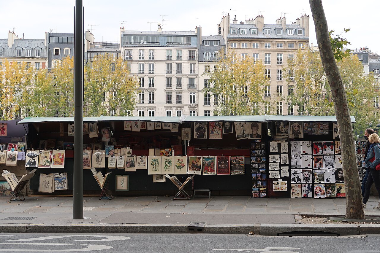
A bookseller's green boxes of prints and posters on the Quai de la MégisseriePolymagou, Wikimedia Commons, CC BY-SA 4.0 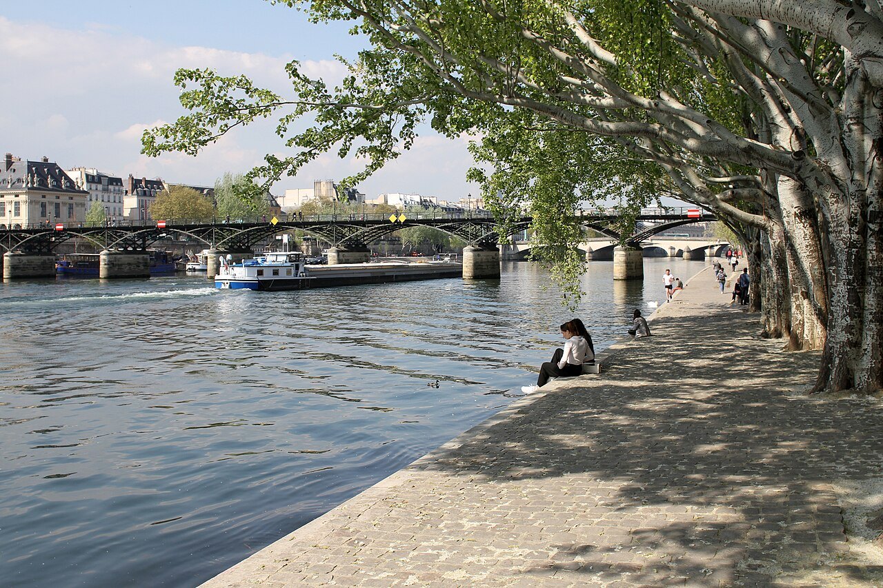
The Pont des Arts from the Square du Vert-Galant, a tour boat passingIlan Costica, Wikimedia Commons, CC BY-SA 4.0 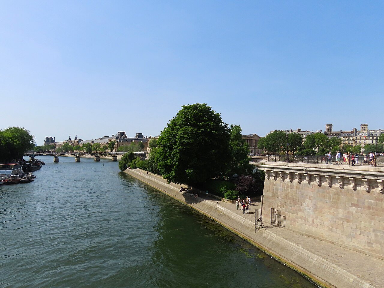
The western tip of the Île de la Cité, the Square du Vert-Galant at the water's edgeRémih, Wikimedia Commons, CC BY-SA 4.0